Road Cycling & Mountain Biking
Benahavis is a paradise for both road cyclists and mountain bikers with many mountain roads and several trails leading away from the village into the mountains. There are also lots of cyclists who use the main road up from the coast to do the hill climb and then return back down the hill to the coast making car drivers a little more aware of cyclists.
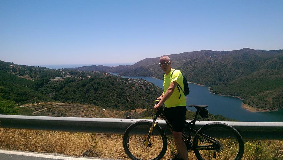
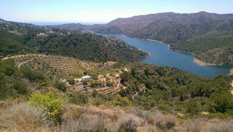
Mountain Biking (Around Benahavis – Entering the mountains from the reservoir)
If you go out of the village and turn towards the football pitches and when you get to the T Junction where you can turn right for the old hotel (it only 50M away at this point) turn left and then follow the road around the back of the sports ground and along a path.
Keep following this and it will take you around the reservoir taking a left where the right fork is private and prohibited to enter.
When you hit the tarmac at the edge of the reservoir turn right and then immediately left up a hill through some gates. This takes you on a variety of routes mainly uphill but if you take a left after about 10-15 mins up a steep hill this will take you properly into the mountains above Benahavis.
Istan (approx 30-35Km each way Road Biking)
If you cycle towards the beach down the hill and then onto Puerta Banus along the beach front from San Pedro Beach.
After you have gone through Puerta Banus turn left towards the mountains and go under the motorway and you should find signs for Istan which is a lovely white washed village!
Ronda (1 Full Day – Road Biking)
For the serious road bikers (I’m guessing about 8-10 hrs return trip and Google says 10 hrs) you can cycle to Ronda over lots of very big scenic mountains (highest point 1065M at Puerto El Madrono) but this is not for the faint hearted or unfit, rather super fit as it’s 55Km each way! Directions to Ronda. I would suggest researching this a little first if you’re thinking of doing it!!
Puerta Verde de Marbella (Mountain Biking Off Road)
It’s probably best to drive to the start of this route first as it’s along the road and will take you an hour to get to but it is possible to cycle there on the mountain bike if you’re going to make a whole day of it. You can start to head towards Rhonda but I think it’s a very long way on the mountain bike so not sure if it’s even possible in a day even one way? Click here for additional info.
Mountain Bike & Road Bike Hire
If you want to hire a bike I would suggest going to Bike Base (formerly Yep Bikes) in San Pedro De Alcantara (approx. 10Km) who charge approx 5-20 Euros for 24 hours for a mountain bike or 14 Euros for a racing bike (road bike). They also provide some premium bikes for a higher price and Electirc e-bikes too. Visit their website for their selection of bikes and contact information Bike Base or Email (info@bikebase.es). Their shop in San Pedro is next to The Hogan Stand Irish Pub. Jan is the owner and he is very helpful. Click here for location.
DRIVE & CYCLE (Further afield)
Los Reales de Sierra Bermeja (Drive 40 Mins first)
About 40 minutes drive away in the National Park of Los Reales de Sierra Bermeja which is a great place for walking, bird watching or you could cycle when you get there (if you can put the bike in the car). To get there head towards Estepona and come off the motorway and go into towards the town centre then take the MA-8301 into the mountains. Click Here for map of Sierra Bermeja
Ride to the top of Los Reales de Sierra Bermeja?
If you want to climb to the top of this mountain it’s about 1450M above sea level which is quite a climb up a mainly tarmac good surface until you get to the last couple of hundred meter climb where is off road for the last 20 mins or so climb.
I headed up the MA-8301 until around the 12KM marker where there was a lay-by to park the car and a water well spring where you can refill your water bottle (useful on the way back down).
If I remember rightly I think it took me about 1Hr 15 mins to get to the top where the mobile mast is and the climb was around 700M perhaps a little more as I don’t know how accurate my Map My Ride App is!
When you get to a junction in the road (3 different ways) take the left road which is single track sized and then when you arrive in a car park near the top bear right and upwards it’s fairly obvious really. It only took me about 17 mins to come back down but I wasn’t hanging around!